


The Significance of Risk Mapping: Geotechnical Services
- September 17, 2023
- Posted by: Velosi Author
- Categories: Geotechnical, Insights

The Significance of Risk Mapping: Geotechnical Services
Introduction
The Oil and Gas industry is evolving and achieving innovative solutions, being a complex yet dynamic sector, one of the key aspects that contribute to the successful operation of this industry is geotechnical services. Risk Mapping plays an important role in ensuring safety, efficiency, and sustainability within the industry.
As Andrew Graham describes risk mapping as displaying assessments along the two axes which define risk: probability and impact (Graham, 2008).
They play a crucial role in the procedure as they initiate the establishment of a shared comprehension of the overall risk landscape. This mapping process yields four distinct quadrants, each possessing its own unique attributes.
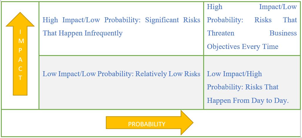
Figure 1 Four Quadrants of Risk
The Role of Risk Management
Inadequate risk management in geotechnical engineering projects can lead to tangible consequences. It is necessary to pinpoint and control risks across all aspects of a construction project. However, geotechnical engineering, which pertains to the foundation and support of a structure, demands special focus. Risk management planning for construction projects, especially those involving pile driving or foundation drilling, poses a challenge due to the potential for soil conditions to change unpredictably.

Geotechnical services encompass the comprehensive analysis of geological materials, the interpretation of their behavior under varying circumstances, and the forecasting of their reactions to modifications. These services are essential within the oil and gas sector as they facilitate the processes of site identification, design formulation, construction execution, operational management, and facility decommissioning.
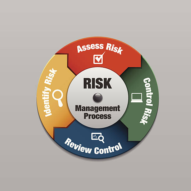
Figure 2 The Process of Risk Management
Understanding Risk Mapping in Geotechnical Services
Risk Mapping is a strategic process structured to identify, assess, and prioritize risk associated with geotechnical operations. A risk map during effective risk management presents a visual representation of potential hazards, their magnitude, and their viable impact on the running project. The process of risk mapping is crucial in the oil and gas industry as it assists in making informed decisions, planning mitigation strategies, maintaining cost-effective solutions, and reducing potential damages.
![]() Risk Mapping in geotechnical services involves the following key points:
Risk Mapping in geotechnical services involves the following key points:
- Site Selection: It helps in identifying suitable locations for drilling or construction of facilities by assessing geological risks such as landslides, earthquakes, or soil liquefaction.
- Design and Construction: By understanding the geotechnical risks, engineers can design structures that can withstand potential hazards.
- Operational Management: Regular risk mapping during operations can help in the early detection of issues like ground movement or instability.
- Facility Decommissioning: This process assists in planning safe decommissioning strategies by identifying potential environmental or structural risks.
The Impact of Risk Mapping on the Oil and Gas Industry
Risk mapping is a systematic approach. It ensures the safety of operations and contributes to economic efficiency, environmental sustainability, and productivity. Moreover, risk mapping can help oil and gas organizations identify and prioritize risks, develop effective mitigation strategies, and effectively communicate risks to stakeholders.
Risk Mapping prioritizes the following three most important points:
- Safety: By identifying potential hazards beforehand, risk mapping contributes to creating a safer working environment.
- Economic Efficiency: It helps to avoid costly damages or shutdowns by utilizing a proactive risk management methodology.
- Environmental Sustainability: It plays an important role in minimizing the overall environmental impact of various operations by identifying potential environmental risks.
The geotechnical risk map holds significant potential for a wide range of applications. It can be particularly beneficial during the initial stages of a project, such as the pre-feasibility phase, where it can aid in the multi-criteria analysis for selecting new transport infrastructure routes, including highways, express roads, railways, and more. Furthermore, this map can also prove invaluable during stages where geotechnical studies are necessitated, such as during the feasibility study or the technical project phase. In these instances, the geotechnical risk map can guide the determination of the volume and type of geotechnical investigations required.
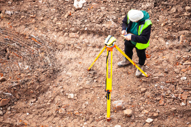 Figure 3 Construction site analysis
Conclusion
To conclude, Risk Mapping is an essential tool for geotechnical services in the oil and gas industry. It provides a roadmap for decision-making, safety, economic efficiency, and environmental sustainability. In this modernized era of rising energy demand and enhanced environmental awareness, the importance of risk mapping cannot be overlooked.
Please contact us for more information and assistance.